- Christmas Island
-
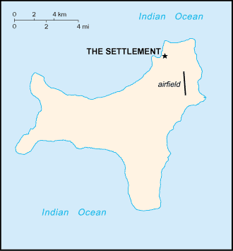 Introduction ::Christmas IslandBackground:Named in 1643 for the day of its discovery, the island was annexed and settlement began by the UK in 1888 with the discovery of the island's phosphate deposits. Following the Second World War, Christmas Island came under the jurisdiction of the new British Colony of Singapore. The island existed as a separate Crown colony from 1 January 1958 to 1 October 1958 when its transfer to Australian jurisdiction was finalized. That date is still celebrated on the first Monday in October as Territory Day. Almost two-thirds of the island has been declared a national park.Geography ::Christmas IslandLocation:Southeastern Asia, island in the Indian Ocean, south of IndonesiaGeographic coordinates:10 30 S, 105 40 EArea:total: 135 sq kmcountry comparison to the world: 222land: 135 sq kmwater: 0 sq kmArea - comparative:about three-quarters the size of Washington, DCLand boundaries:0 kmCoastline:138.9 kmMaritime claims:territorial sea: 12 nmcontiguous zone: 12 nmexclusive fishing zone: 200 nmClimate:tropical with a wet season (December to April) and dry season; heat and humidity moderated by trade windsTerrain:steep cliffs along coast rise abruptly to central plateauElevation extremes:lowest point: Indian Ocean 0 mhighest point: Murray Hill 361 mNatural resources:phosphate, beachesLand use:arable land: 0%permanent crops: 0%other: 100% (mainly tropical rainforest; 63% of the island is a national park) (2011)Irrigated land:NANatural hazards:the narrow fringing reef surrounding the island can be a maritime hazardEnvironment - current issues:loss of rainforest; impact of phosphate miningGeography - note:located along major sea lanes of Indian OceanPeople and Society ::Christmas IslandNationality:noun: Christmas Islander(s)adjective: Christmas IslandEthnic groups:Chinese 70%, European 20%, Malay 10%note: no indigenous population (2001)Languages:English (official), Chinese, MalayReligions:Buddhist 36%, Muslim 25%, Christian 18%, other 21% (1997)Population:1,513 (July 2013 est.)country comparison to the world: 234Population growth rate:1.12% (2013 est.)country comparison to the world: 106Sex ratio:NA (2009 est.)Infant mortality rate:total: NAmale: NAfemale: NALife expectancy at birth:total population: NAmale: NAfemale: NATotal fertility rate:NAHIV/AIDS - adult prevalence rate:NAHIV/AIDS - people living with HIV/AIDS:NAHIV/AIDS - deaths:NALiteracy:NAGovernment ::Christmas IslandCountry name:conventional long form: Territory of Christmas Islandconventional short form: Christmas IslandDependency status:non-self governing territory of Australia; administered from Canberra by the Department of Regional Australia, Local Government, Arts and SportGovernment type:NACapital:name: The Settlementgeographic coordinates: 10 25 S, 105 43 Etime difference: UTC+7 (12 hours ahead of Washington, DC during Standard Time)Administrative divisions:none (territory of Australia)Independence:none (territory of Australia)National holiday:Australia Day, 26 January (1788)Constitution:Christmas Island Act 1958-59 (1 October 1958); amended by Territories Law Reform Act 1992Legal system:legal system is under the authority of the governor general of Australia and Australian lawSuffrage:18 years of ageExecutive branch:chief of state: Queen ELIZABETH II (since 6 February 1952) represented by the Australian governor generalhead of government: Administrator Jon STANHOPE (since 5 October 2012)elections: the monarchy is hereditary; governor general appointed by the monarch on the recommendation of the Australian prime minister; administrator appointed by the governor general of Australia for a two-year term and represents the monarch and AustraliaLegislative branch:unicameral Christmas Island Shire Council (9 seats; members elected by popular vote to serve four-year terms)elections: held every two years with half the members standing for election; last held In 2011 (next to be held in 2013)election results: percent of vote - NA; seats - independents 9Judicial branch:highest court(s): under the terms of the Territorial Law Reform Act 1992, Western Australia provides court services as needed for the island including the Supreme Court and subordinate courts (District Court, Magistrate Court, Family Court, Children's Court, and Coroners' Court)judge selection and term of office:subordinate courts:Political parties and leaders:nonePolitical pressure groups and leaders:noneInternational organization participation:noneDiplomatic representation in the US:none (territory of Australia)Diplomatic representation from the US:none (territory of Australia)Flag description:territorial flag; divided diagonally from upper hoist to lower fly; the upper triangle is green with a yellow image of the Golden Bosun Bird superimposed; the lower triangle is blue with the Southern Cross constellation, representing Australia, superimposed; a centered yellow disk displays a green map of the islandnote: the flag of Australia is used for official purposesNational symbol(s):golden bosun birdNational anthem:note: as a territory of Australia, ""Advance Australia Fair"" remains official as the national anthem, while ""God Save the Queen"" serves as the royal anthem (see Australia)Economy ::Christmas IslandEconomy - overview:The main economic activities on Christmas Island are the mining of low grade phosphate, limited tourism, the provision of government services and more recently the construction and operation of the Immigration Detention Center. The government sector includes administration, health, education, policing, customs, quarantine and defense.GDP (purchasing power parity):$NAAgriculture - products:NAIndustries:tourism, phosphate extraction (near depletion)Labor force:NABudget:revenues: $NAexpenditures: $NAFiscal year:1 July - 30 JuneExports:$NAExports - commodities:phosphateImports:$NAImports - commodities:consumer goodsExchange rates:Australian dollars (AUD) per US dollar -0.9658 (2012)0.9695 (2011)1.0902 (2010)1.2822 (2009)1.2059 (2008)Communications ::Christmas IslandTelephone system:general assessment: service provided by the Australian networkdomestic: GSM mobile-cellular telephone service replaced older analog system in February 2005international: country code - 61-8; satellite earth station - 1 (Intelsat provides telephone and telex service) (2005)Broadcast media:1 community radio station; satellite broadcasts of several Australian radio and TV stations (2009)Internet country code:.cxInternet hosts:3,028 (2012)country comparison to the world: 155Internet users:464 (2001)country comparison to the world: 217Transportation ::Christmas IslandAirports:1 (2013)country comparison to the world: 223Airports - with paved runways:total: 11,524 to 2,437 m: 1 (2013)Railways:total: 18 kmcountry comparison to the world: 133standard gauge: 18 km 1.435-m (not in operation) (2010)Roadways:total: 140 kmcountry comparison to the world: 211paved: 30 kmunpaved: 110 km (2007)Ports and terminals:major seaport(s): Flying Fish CoveMilitary ::Christmas IslandMilitary - note:defense is the responsibility of AustraliaTransnational Issues ::Christmas IslandDisputes - international:none"
The World Factbook. 2014.